Sentinel-1 for Science Ocean Study
Sentinel-1 (© ESA)
short name: S1OceanStudy
Kick-Off: October 2015
Project duration: 24 months
Project related web sites:
Project consortium
The objective of the ESA’s SEOM Programme S1 Ocean Study project is the scientific development and validation of improved L2 ocean product prototypes using Sentinel-1 mission acquisitions and fulfilling the requirements of the wide user community. This opportunity is extremely interesting given the challenges and possibilities offered by the characteristics Sentinel-1 SAR instrument. A consortium formed to address this issue includes the following partners:
- CLS, France (Prime contractor)
- IFREMER, France
- NORUT, Norway
- OCEANDATALAB, France
Project objectives
The objective of this study is to develop improved L2 ocean product prototypes for Sentinel-1 mission fulfilling the requirements of the wide ocean user community. Those prototype products will aim at:
- Taking benefit of the new capabilities of the S-1 mission acquisition modes in order to improve the surface ocean sea state measurements (wind, waves, swell, currents),
- Implementing a synergetic ocean sea state measurement strategy in order to overcome the limitation of classical measurement approaches,
- Providing ocean sea state measurements required by the user community (both operational community and scientific community)
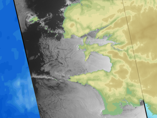
 Two neighboring polar lows caught off the coast of Greenland by the Extended Wide swath mode of Sentinel-1 on 2015/10/05 at 08H47. |
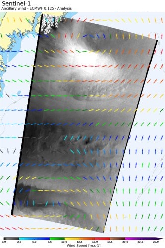
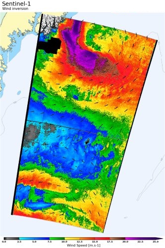 The surface wind field is estimated based on the roughness image and ancillary information. Maximum wind speed estimated over the scene reaches 28 m/s. Credits: S1 data from ESA, Analyzed by CLS |