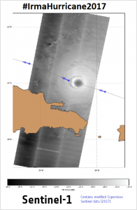
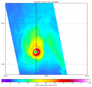
Irma was the strongest hurricane ever measured in the North Atlantic (on a par with the strongest North Pacific typhoons). The damages it caused for populations and infrastructures are still under assessment, but losses and costs will definitely be huge.
A number of satellites have been mobilized to forecast and assess the phenomena and the following hurricanes, and to help the emergency rescue teams.
Sentinel-1 A & B, which acquisitions were not at first optimized for such phenomena, were specifically programmed to observe the hurricane Irma as it moved. Others satellites were also used to monitor the exceptional series of hurricanes of September 2017, and also to assess the damages afterwards.
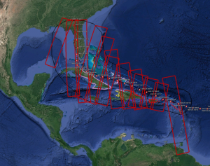
Sentinel-1 acquisitions programmed for Hurricane Irma, following the forecasted path of the cyclone (6 to 10 September 2017). (Credits Ifremer-LOPS )
The SEOM S1 for Ocean study project has in particular the objective of improving wind and wave retrieval from SAR (Sentinel-1) imagery, especially in extreme conditions where SAR-derived wind measurements are usually largely under-estimated. Taking advantage of the cross-polarization channel, a dedicated wind retrieval algorithm was developed to avoid co-polarized channel limitations in extreme conditions. This was allowed by the numerous Sentinel-1 acquisitions over hurricanes performed in summer 2016 in collaboration with Sentinel-1 ground segment. Observing Irma constitutes a kind of test for this project, since such extreme events are out of the normal range of expected values, and thus are always a challenge for observing systems.
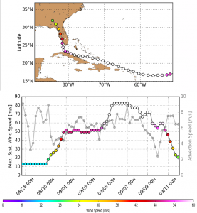
Hurricane Irma path (with wind speed color-coded), Wind evolution along time as analyzed by NHC (best-track data) (Credits Ifremer-LOPS )
Acquisition over Irma on September 7th, 2017 is the first SAR image ever capturing a hurricane for such a high wind speeds (as reported by Hurricanes experts). Wind field algorithms developed in the framework of the ESA SEOM program report wind speed up to 80-85 m/s (about 300 km/h). The following hurricanes (Jose and Maria) were also monitored using S1.
The provided polarization channels gave very interesting results, with the cross-polarisation (VH) much more sensitive to extreme sea states than the parallel polarization one (VV). This opens perspectives for measuring wind speeds over extreme with new algorithms for Sentinel-1 and the next MeTop SG scatterometer (VH capabilities).
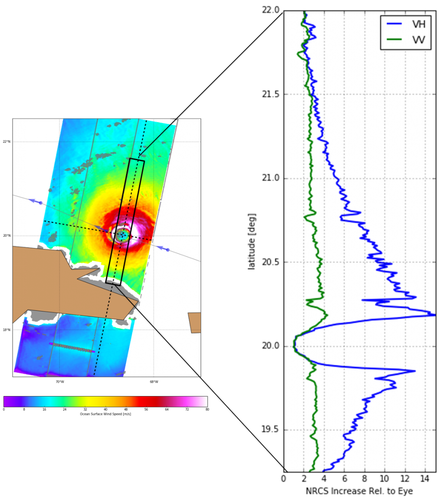
Wind speed for Irma (Sept.7th acquisition), and the sensitivity of the two polarizastions. The sensitivity of SAR backscatter to ocean surface wind speed in VH is much stronger that in VV. (Credits Ifremer-LOPS )
The algorithms developed in the framework of ESA SEOM program can thus be used to provide geophysical parameters over hurricanes, even if some improvements can still be brought to them, made possible in particular thanks to other observations (in that case, SMOS was collocated with S1 over Irma and Jose). Specific acquisitions are to be thought of in that frame.
